By Ori Gudes, City Futures Research Centre.
Australia’s cities face significant social, economic and environmental challenges, driven by population growth and rapid urbanisation. The pressure to increase the availability of housing, including a move to a more compact urban form, will lead to greater levels of high-density and medium-density stock. However, there is also political and community pushback against this, due to the historical availability of land and the cultural norm of detached housing on large lots. One of the ways to address this challenge is to encourage medium-density living solutions through “precinct” scale development, as opposed to lot-by-lot redevelopment, which, due to economies of scale and optimum use of land, has the potential to include additional hand and soft infrastructure, which may offset the perceived negativities of higher densities. As part of Australian research into precinct scale development, new digital planning tools (Envision and ESP) have been developed to support scenario planning and design. This is a data-driven and scenario planning approach, where Geographic Information Systems (GIS) is utilised.
In this study, we focus on a case study undertaken in the City of Blacktown, Western Sydney, New South Wales, Australia. By 2036 the City of Blacktown is forecast to grow to approximately 500,000 people (an increase of over 30%) and 180,000 dwellings from its current size. The majority of new dwellings will be delivered through urban infill. The Blacktown master plan promotes higher density forms of housing, a mixture of employment uses, continued improvements to the public domain, provision of pedestrian oriented streets, open spaces and green linkages. Therefore, our research project provides a unique opportunity to implement this broad strategy within a specific case study and location.
During February the team delivered training session on specific scenario planning tools (Envision and ESP) developed as an integral part of this project.
Envision has three core tools:
- Multi-criteria evaluation, which uses statistics at the Australian Bureau of Statistics’ statistical area level one scale to identify lots that meet user-defined criteria, such as the count of housing types or population by age etc;
- Redevelopment potential, which allows the user to define parameters such as ‘distance from major roads’ or ‘distance to train station’ and will identify lots that meet these parameters in addition to including or excluding properties that have constraints such as ‘environmental management’, ‘sensitive areas’ or ‘heritage protected sites’;
- Viability assessment, which will give a simple summary of the potential redevelopment outcomes of a user-defined precinct, including variables such as housing typology and quality.
Envision enables a data-driven approaches and less subjective method of identifying precincts that have potential for redevelopment. When a precinct has been identified in Envision, a user can export the property boundaries in a spatial data or GIS format that can be imported into ESP, meaning the two tools are easily integrated.
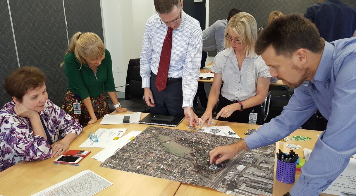
During March 2018 an important mile stone was met, as group of participants convened to discuss about future design scenarios of the proposed location. Two sub group were simultaneously working on design scenarios, one of the groups used (on-the-fly) the ESP tool as part of their design work. The workshop was a great success, and we are now moving on to develop the feasibility model and seek endorsement from the city council as the project progresses.
The research team has recently published a paper in the State of Cities Conference, held in Adelaide last November. The paper suggests a data-driven approach, where Geographic Information Systems (GIS) and scenario planning tools (Envision and ESP) are employed in conjunction with local planners and the community to deliver a collaborative solution. It also presents a conceptual framework for future participatory-planning processes.